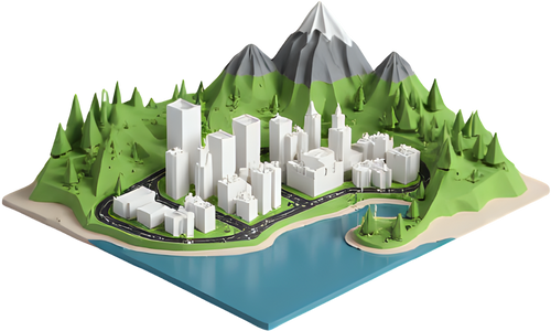
Put real landscapes in students' hands. Each kit has an age band, learning goals, one-click 3D models, print settings, discussion questions and a hands-on activity. Free, no accounts, nothing to install.
150 mm wide, 5 mm base, 0.2 mm layers, 10–15% infill, no supports needed. Fuji and Mauna Loa are set to the same 25 km area, the same 150 mm size and the same 1.5× vertical exaggeration, so their slopes can be compared fairly.
Printing time is a rough guide: it depends on the printer, layer height and infill. The app shows an estimate after generating. As a rough idea, expect a few hours per model, and up to an overnight print for tall relief.
Discussion questions
Which of the two big volcanoes has steeper sides? How can you tell without measuring?
Runny lava travels far before it cools. Which volcano do you think was built by runny lava, and why?
The crater of Mount St. Helens is open on one side. Which way does it open, and what might that say about how it erupted?
If you lived near one of these volcanoes, where would you build a town, and where would you avoid?
Hands-on activity
Slope race: with a ruler, measure how far each model rises (in mm) over a set distance from the summit. Divide rise by distance to compare slopes. Then put each print on a tray and pour a spoon of dry rice or sand from the summit: where does it run, and how far?
Models for this kit: terraprinter.com/classroom/#volcanoes
Plate boundaries and rift valleys
Ages 11–16Earth science, geography
Learning goals
Describe what happens at a divergent plate boundary.
Identify a rift valley (graben) and the steep fault scarps on each side.
Explain why lakes and volcanoes are often found in rift valleys.
150 mm wide, 5 mm base, 0.2 mm layers, 10–15% infill, no supports needed. The Kenyan rift is 80 km across, so its walls are drawn 3× taller than true scale to show up in print; Þingvellir uses 2×. Talk about this exaggeration with the class.
Printing time is a rough guide: it depends on the printer, layer height and infill. The app shows an estimate after generating. As a rough idea, expect a few hours per model, and up to an overnight print for tall relief.
Discussion questions
Find the valley floor and the high ground on either side. Why is the middle lower than the edges?
Iceland sits on the boundary between the North American and Eurasian plates. If the plates move apart, what happens to the valley over millions of years?
Why might lakes form along a rift valley?
Both models show rifts, but at very different sizes. What is similar, and what is different?
Hands-on activity
Graben in a box: stand three blocks of foam or wood side by side, with the middle block cut as a wedge narrower at the bottom. Slowly pull the outer blocks apart and watch the middle one drop. Then find the same pattern on the prints and mark each fault scarp with a washable marker.
Models for this kit: terraprinter.com/classroom/#rift-valleys
Watersheds and rivers
Ages 10–15Geography, environmental science
Learning goals
Define a watershed (drainage basin) and a drainage divide.
Predict which way water flows from contour lines and relief.
Recognise a radial drainage pattern around a central dome of hills.
150 mm wide, 5 mm base, 0.2 mm layers, 10–15% infill, no supports needed. Contour lines are raised ridges every 100 m. The lakes are cut into the terrain, so they show up even on a single-colour print.
Printing time is a rough guide: it depends on the printer, layer height and infill. The app shows an estimate after generating. As a rough idea, expect a few hours per model, and up to an overnight print for tall relief.
Discussion questions
Find the highest ground. In which directions do the long lakes and valleys point away from it?
Pick a spot on a hillside. Which lake or river would a raindrop landing there end up in?
Where are the drainage divides between one valley and the next?
Pollution entering a stream high in a watershed: who downstream is affected?
Hands-on activity
Drip test: put the print on a tray and use a dropper to place water drops on different hilltops. Follow where each drop runs. Draw the divides between valleys with a washable marker, then colour each watershed a different colour.
Models for this kit: terraprinter.com/classroom/#watersheds
Glaciers and U-shaped valleys
Ages 11–16Geography, Earth science
Learning goals
Tell a glacier-carved U-shaped valley from a river-cut V-shaped valley.
Identify hanging valleys, steep valley walls and a valley glacier.
150 mm wide, 5 mm base, 0.2 mm layers, 10–15% infill, no supports needed. Elevation is the glacier's surface, so the ice prints as part of the terrain. A white filament change at a set height makes the high ground stand out.
Printing time is a rough guide: it depends on the printer, layer height and infill. The app shows an estimate after generating. As a rough idea, expect a few hours per model, and up to an overnight print for tall relief.
Discussion questions
Look straight down the Lauterbrunnen valley. Is its cross-section shaped more like a U or a V?
Side valleys end high above the main valley floor. What do you think happens to their streams?
On the Aletsch model, where does the ice come from, and which way is it flowing?
If the Aletsch Glacier melted away, what shape of valley would it leave behind?
Hands-on activity
Valley profiles: lay a strip of card across each valley and mark the height of the terrain every centimetre with a ruler held upright. Plot the heights on graph paper to draw a cross-section, then compare the U shape with a river valley from another model.
Models for this kit: terraprinter.com/classroom/#glaciers
Coastlines and the sea floor
Ages 11–16Geography, Earth science
Learning goals
Read land and sea-floor relief on one model.
Explain how a volcanic caldera filled by the sea forms.
Reason about sea level, scale and why coastal risk maps need detailed data.
150 mm wide, 5 mm base, 0.2 mm layers, 10–15% infill, no supports needed. These use bathymetry mode, which prints the real sea floor instead of a flat sea. Sea-floor data is much coarser than land data, so underwater shapes look smoother; that works best for areas of 10 km and up.
Printing time is a rough guide: it depends on the printer, layer height and infill. The app shows an estimate after generating. As a rough idea, expect a few hours per model, and up to an overnight print for tall relief.
Discussion questions
On the Santorini model, find today's coastline. How deep is the flooded caldera compared with how high the cliffs rise?
The islands form a broken ring. What could have made a ring shape?
At this scale, 1 mm of model height is many metres of real height. Could a 1 m rise in sea level be seen on this print? What does that tell you about the data needed to plan for sea-level rise?
Why does a narrow, shallow strait like Gibraltar matter for ocean water and for ships?
Hands-on activity
Scale it: work out the vertical scale (model size in mm ÷ real width in metres × vertical exaggeration) and use it to convert the depth of the caldera from millimetres on the print into real metres. Check the answer against a published depth.
Models for this kit: terraprinter.com/classroom/#coastlines
Mars: the biggest volcano and canyon
Ages 9–16Space science, Earth science
Learning goals
Compare landforms on Mars with similar ones on Earth.
150 mm wide, 5 mm base, 0.2 mm layers, 10–15% infill, no supports needed. Real NASA elevation. These areas are hundreds of kilometres wide, so the app draws Mars relief 4× taller than true scale by default; at true scale they would print almost flat.
Printing time is a rough guide: it depends on the printer, layer height and infill. The app shows an estimate after generating. As a rough idea, expect a few hours per model, and up to an overnight print for tall relief.
Discussion questions
Olympus Mons is a shield volcano, like Mauna Loa. Compare their shapes. What is similar?
Olympus Mons rises about 22 km. How many times the height of Mount Everest (about 8.8 km) is that?
Mars has lower gravity and no moving plates like Earth's. How could each of those let a volcano grow so big?
Valles Marineris is about 4,000 km long. Which places on Earth are about that far apart?
Hands-on activity
Planet-scale comparison: print Olympus Mons alongside the Mauna Loa model from the volcano kit. On a sheet of paper, draw a 600 km circle (roughly the width of Olympus Mons) and a map of your country or state at the same scale to compare.
Models for this kit: terraprinter.com/classroom/#mars
The Moon: craters and Apollo sites
Ages 8–14Space science
Learning goals
Describe the parts of an impact crater: rim, walls, floor and central peak.
Explain why craters last so long on the Moon.
Connect landing-site choice with the terrain astronauts needed.
150 mm wide, 5 mm base, 0.2 mm layers, 10–15% infill, no supports needed. Real NASA LRO elevation, drawn taller than true scale so the relief shows. Grey filament suits the Moon.
Printing time is a rough guide: it depends on the printer, layer height and infill. The app shows an estimate after generating. As a rough idea, expect a few hours per model, and up to an overnight print for tall relief.
Discussion questions
Find Tycho's rim, its terraced walls and the mountain in the middle. How do you think the central peak formed?
The Moon has no wind, rain or rivers. What does that mean for how long a crater stays sharp?
Compare the Apollo 11 and Apollo 15 areas. Why might the first landing have picked flatter ground?
What would be hard about driving a rover around Hadley Rille?
Hands-on activity
Make craters: fill a tray with flour and sprinkle a thin layer of cocoa on top. Drop marbles or pebbles from different heights and measure each crater's width. Compare the shapes, and the splashed-out cocoa, with the Tycho print.
Models for this kit: terraprinter.com/classroom/#moon
Map reading with contour lines
Ages 9–14Geography, map skills
Learning goals
Explain what a contour line is and what the interval means.
Read steep and gentle slopes from contour spacing.
Recognise hills, ridges and valleys from contour shapes.
150 mm wide, 5 mm base, 0.2 mm layers, 10–15% infill, no supports needed. Contour lines are raised ridges on the print, so students can feel them as well as see them. Half Dome is at true scale (1×), so its cliff is as steep as the real one.
Printing time is a rough guide: it depends on the printer, layer height and infill. The app shows an estimate after generating. As a rough idea, expect a few hours per model, and up to an overnight print for tall relief.
Discussion questions
Where are the contour lines close together, and where are they far apart? Which is the steep side?
Find the summit. If you count the lines from the bottom, how high is it above the lowest point?
Which way up the hill would be the easiest walk? Why?
Contour lines bend into a V where they cross a valley. Can you find one?
Hands-on activity
Make your own contour map: stand the print in a clear, straight-sided container and add water 1 cm at a time. After each step, trace the waterline from directly above onto a sheet of clear acetate. The traced lines are a contour map of the model; compare it with the raised lines.
Models for this kit: terraprinter.com/classroom/#contours
Printing for a class
Puzzle pieces for group work
Puzzle mode cuts one model into interlocking pieces. Give each group a piece to describe, then put the landscape back together. This example makes the Grand Canyon 200 mm wide in about 16 jigsaw pieces of 50 mm.
Grid slice cuts a large model into tiles that each fit the printer, so several printers, or several days, can share the work. This example makes the Lake District 300 mm wide as four 150 mm tiles, with contour lines.
Printing time grows quickly with size, so a set of 100 mm models prints much faster than 150 mm ones. Start prints at the end of the day to run overnight, and check the app's filament and time estimate before committing.
No printer yet?
Every model has an interactive 3D preview, and View in your room shows it in AR on a phone or tablet. Many public libraries and makerspaces also offer 3D printing.
No accounts, no student data
Nobody needs to sign up or type in personal details: models are built in the browser and download straight away. The site records usage statistics such as pages opened and areas modelled, tied to a random browser ID rather than a name; see the privacy policy. Optional accounts are not meant for children under 13.
Make it local
Every kit works just as well with somewhere near your school. Search for a local hill, river or coastline in the app, and turn on buildings and roads so students can find their own streets.
Start with your own area
Free, no account needed, and every model downloads as STL or 3MF for your school's printer.