 TerraPrinter

Ignores elevation and prints a flat base plate carrying just the OSM features (buildings, roads, water…). Great for a clean city map.
Fine-tune the print readability of each OSM layer. Heights are multiplied on top of the terrain vertical exaggeration; widths only apply to line features (roads, trails, rail) and scale the OSM-tag width before the min-width floor kicks in.
Scatters low-poly 3D trees across park & greenery polygons in the printed model. Applies on the next Generate / export.
Adds a raised picture-frame rim around the model — a clean base with room for a place-name plaque. Single-piece models only.
Import one or more hikes/rides (.gpx) and emboss each as its own raised ridge on the terrain — every route gets its own colour and prints on its own filament. Make sure your selection covers the routes.
Raised topographic lines at fixed elevation steps — adds a classic relief-map read, especially for single-colour prints.
Splits the terrain surface into printable colour regions, each printing as a thin coat welded onto the base terrain on its own filament — made for AMS / MMU / toolchanger printers. Applies on the next Generate / export.
Colours by natural land-cover (forest, grass, rock, sand, glacier) from OpenStreetMap. Untick a type to leave it as bare terrain; water keeps the Water layer colour.
Reduces the currently selected basemap imagery to a few filament colours and splits the surface into those regions. After Generate, recolour any swatch below to match the filaments you actually have loaded.
The extracted palette appears here after you Generate.
Draw your own buildings with the tools below — they extrude into the model and always print, even with the OSM buildings layer off. Pick a tool and draw on the map; then hit Done and click a building (or a row below) to move, rotate, resize, or change its height.
MapLibre Globe Edition — live 3D terrain, hillshade, and building extrusions in your browser.
Elevation: Copernicus DEM via WCS · OSM features · Three.js export.
Classic version
© Capital Coders Inc.
Built with by Jordan Harding
TerraPrinter
3D Preview
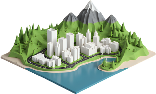
Turn any place on Earth into a 3D‑printable model — real terrain, buildings, roads and water. This quick tour shows you the 5 steps from map to model.
Takes about 30 seconds.
Type a city, mountain, park or address into the search bar at the top. The map flies you there. You can also just pan and zoom to explore.
Try “Grand Canyon”, “Manhattan”, or your hometown.
On the right toolbar, pick a shape — rectangle, square, circle, hexagon or free‑draw polygon — then drag on the map to outline the area you want to print.
Drag the handles to resize or rotate your selection.
Use the toolbar toggles to layer in real OpenStreetMap features on top of the terrain — or keep it as pure landscape.
Want a flat city map? Open Settings → turn on Flat model.
Hit the gear to adjust print size, vertical exaggeration, base thickness, colours, and styles like Puzzle or Minecraft. The defaults already print great.
Higher exaggeration makes hills pop on flatter areas.
Press the big Generate 3D Model button. Preview it in 3D or AR, then download a print‑ready STL, 3MF, OBJ or GLB for your slicer.
That’s it — you’re ready to print. Have fun!
roof:direction / roof:orientation tags. Parliament Hill, churches, and detailed buildings read correctly instead of as flat boxes or pyramids.building:part massing — towers, spires, tiered roofs, arches — so the preview matches the printed model instead of showing flat-topped boxes. Part footprints that replace a base outline are dropped, and raised parts sit at their correct min_height./osm/ endpoint backed by a full-planet osm2pgsql import (~686M buildings, 260M highways, 62M water, 86M landcover, 30M structures). Fetching is now cache-friendly, rate-limit free, and dramatically faster for dense cities like Boston, NYC, and London. A single config constant lets the frontend fall back to the public Overpass API if the local mirror is ever down.localStorage and flow through to the GLB preview. Defaults match the historical built-in palette so existing models look unchanged until you pick new colors.<m:basematerials> resource with one base color per layer, and each object references it via pid/pindex. Slicers like Bambu Studio and PrusaSlicer now open exported 3MF files with every layer pre-assigned its correct color for multi-material printing — previously 3MF files opened as a single gray object.bridge=yes are preserved when they cross water (instead of getting clipped) and their deck is anchored to a flat approach-terrain Z instead of sampling the DEM river bed. Bridges now render as seamless continuations of the road network crossing rivers, with printable flat slabs that connect cleanly to the approach roads at both ends.tunnel=yes (roads, trails, or railways) is skipped entirely. Approach roads — which are separate non-tunnel OSM ways — naturally terminate at the portal location, giving a clean entrance/exit appearance without synthesizing portal geometry.